Home
The Team
Vision, Goals and Objective Statements
Site Analysis
Strengths and Opportunities
Hard Soft Analysis
Business Survey
Environmental Resources Plan
Public Spaces Plan
Character and Emerging Districts
Maps
Vicinity Map
Bubble Diagram
Existing Land Use
Proposed Land Use
Connectivity
Conceptual Plan
Lighting Map
Hard Soft Analysis
Photos
Planning Studio 2014 Document
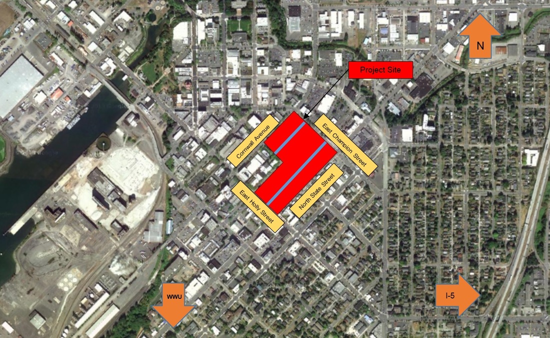
project vicinity map
Our project site area includes the alley ways between North State Street, Cornwall Avenue, East Holly Street and East Champion Street. The alley ways are represented as blue lines here.